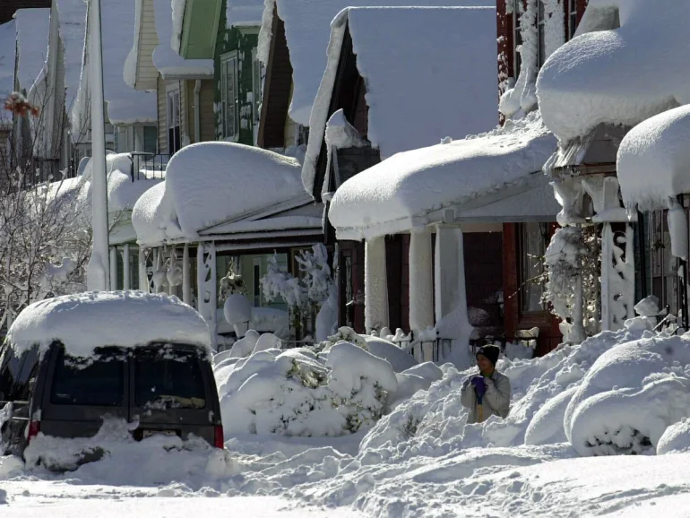
Two massive winter storm systems gripped much of the eastern United States over the Martin Luther King Jr. holiday weekend in January 2026, bringing rare snowfall to southern states, heavy accumulations in the Northeast, and widespread travel chaos.
Roughly 55 million people across the northern Plains, Great Lakes, Northeast, and parts of the Southeast were under winter weather alerts. One system stretched a long band of snow and rain from the Gulf Coast up through the Northeast, while a separate storm delivered heavy snow and blizzard conditions to areas like the Dakotas and Minnesota before shifting eastward.
The southern reach of the storm was especially unusual. Snow fell as far south as the Florida Panhandle, Georgia, and Alabama—marking the second consecutive year that Florida has seen measurable snow. In the Panhandle, areas like Pensacola and nearby towns reported light accumulations, with some spots seeing up to 1–2 inches, though much of it melted quickly on warmer ground. Farther north, snowfall totals included 5 inches in Whitefield, New Hampshire; 4.5 inches in Saratoga Springs, New York; 3 inches in Smithville, Georgia; and 2.8 inches in Lancaster, Massachusetts. Even Gillette Stadium in Foxborough, Massachusetts, saw snow during an NFL playoff game between the Houston Texans and New England Patriots.
Travel across the eastern U.S. suffered major disruptions during this peak holiday period. More than 4,100 flights were delayed and 442 canceled nationwide, according to FlightAware. Northeast airports bore the worst impacts: New York’s John F. Kennedy International and LaGuardia airports led in delays and cancellations due to snow and freezing temperatures. A ground delay program was also implemented at Newark Liberty International Airport. Roads turned treacherous, with chain-reaction crashes reported, including a multi-vehicle pileup on Interstate 78 in Berks County, Pennsylvania, caused by slick conditions.
In the Northeast, heavier snow was expected in places like New York City and Philadelphia (1–4 inches) and the Boston area (3–6 inches). New York Governor Kathy Hochul urged residents to limit travel, stock supplies, check on vulnerable neighbors, and stay informed through Tuesday, warning that strong winds could lead to power outages.
A separate northern system brought intense lake-effect snow to parts of the Great Lakes region, with potential accumulations of 6–12 inches in western Michigan, western Pennsylvania, and western New York. New York’s Tug Hill Plateau could see 2–3 feet in some spots. Blizzard conditions with 60 mph wind gusts created whiteout visibility in the Dakotas and Minnesota early on.
Adding to the misery, an Arctic air mass plunged temperatures well below average across the eastern half of the country. Highs ran 10–20 degrees below normal, with single digits and teens in the northern Plains and 20s to 40s farther south. Cold weather alerts covered about 51 million people in the Great Plains, Ohio Valley, and Southeast, and another 42 million in the Midwest—including cities like Chicago, Minneapolis, and Milwaukee—where wind chills dipped to 20–35 degrees below zero. Even parts of Alabama and Florida faced unusually low wind chills in the upper 20s.
The storms highlighted how extreme weather can upend plans during busy travel times. Officials and the National Weather Service recommended limiting non-essential travel, preparing vehicles with emergency kits, monitoring forecasts and road conditions, and staying safe in the cold to avoid risks like frostbite or hypothermia. As the systems moved out, conditions were expected to gradually improve early in the week, though lingering cold persisted in many areas.